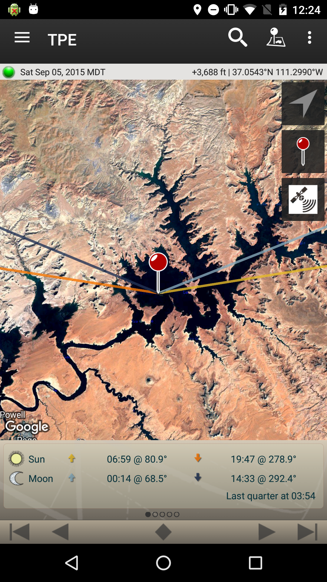
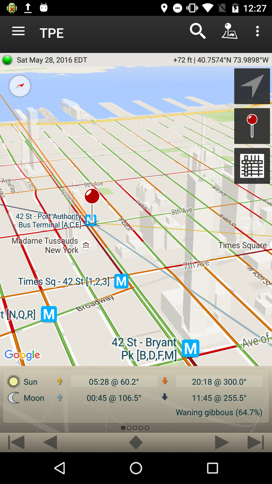
TPE is a map-centric sun and moon calculator: see how light will fall on earth, day or night, for almost anywhere on earth.
Ideal for landscape, wildlife, travel and outdoor photographers, TPE’s mapping approach allows you to search for any place name on the planet or place the map pin exactly where you want.
Advanced features include: automatic time zone and altitude detection, correction of atmospheric refraction and altitude above the horizon. You can even control when the sun or moon will be visible behind nearby hills and mountains.
Five types of maps are available, including two topographic maps, ideal for landscape and wildlife photographers. Open Street Map and Open Cycle Map Topographic have automatic offline support: any tiles you view are automatically cached for offline use.
Most important features:
– Time and direction of sunrise and sunset
– Time and direction of moonrise and moonset
– Moon phase and% illumination
– Civil, nautical and astronomical twilight time
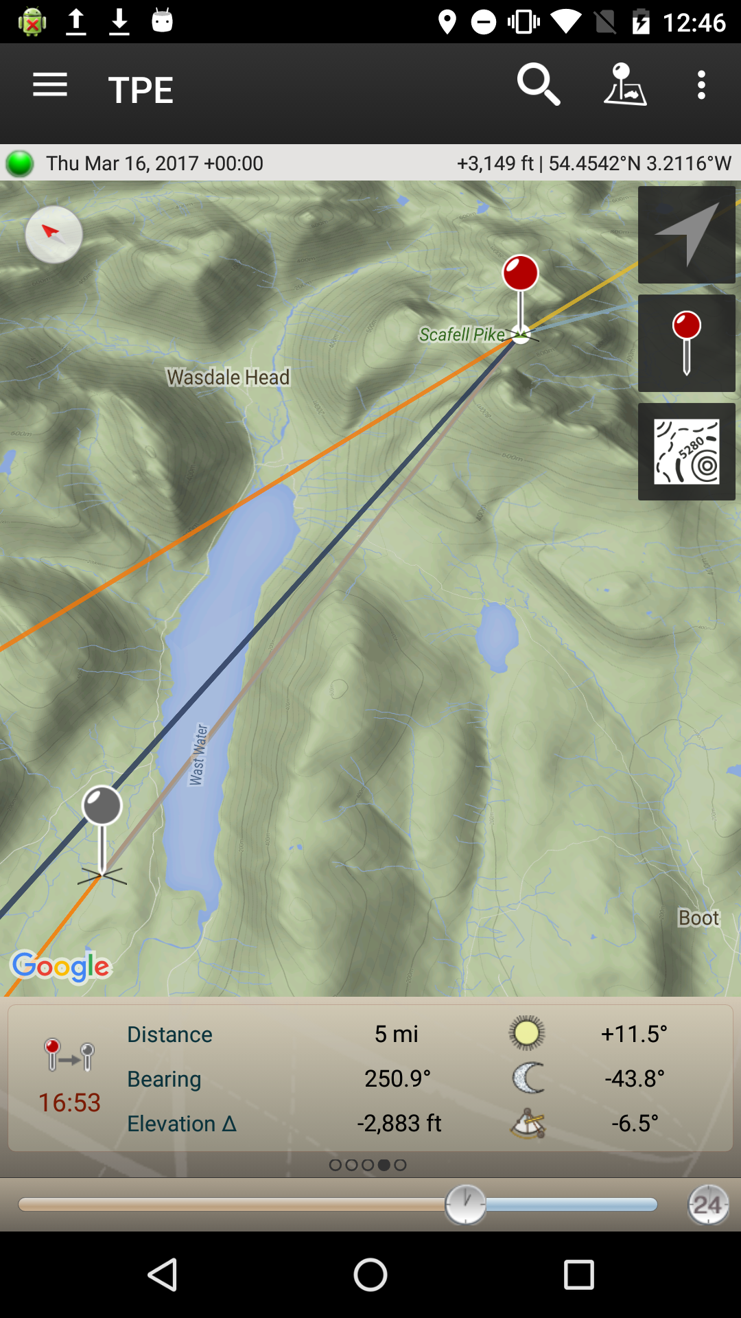
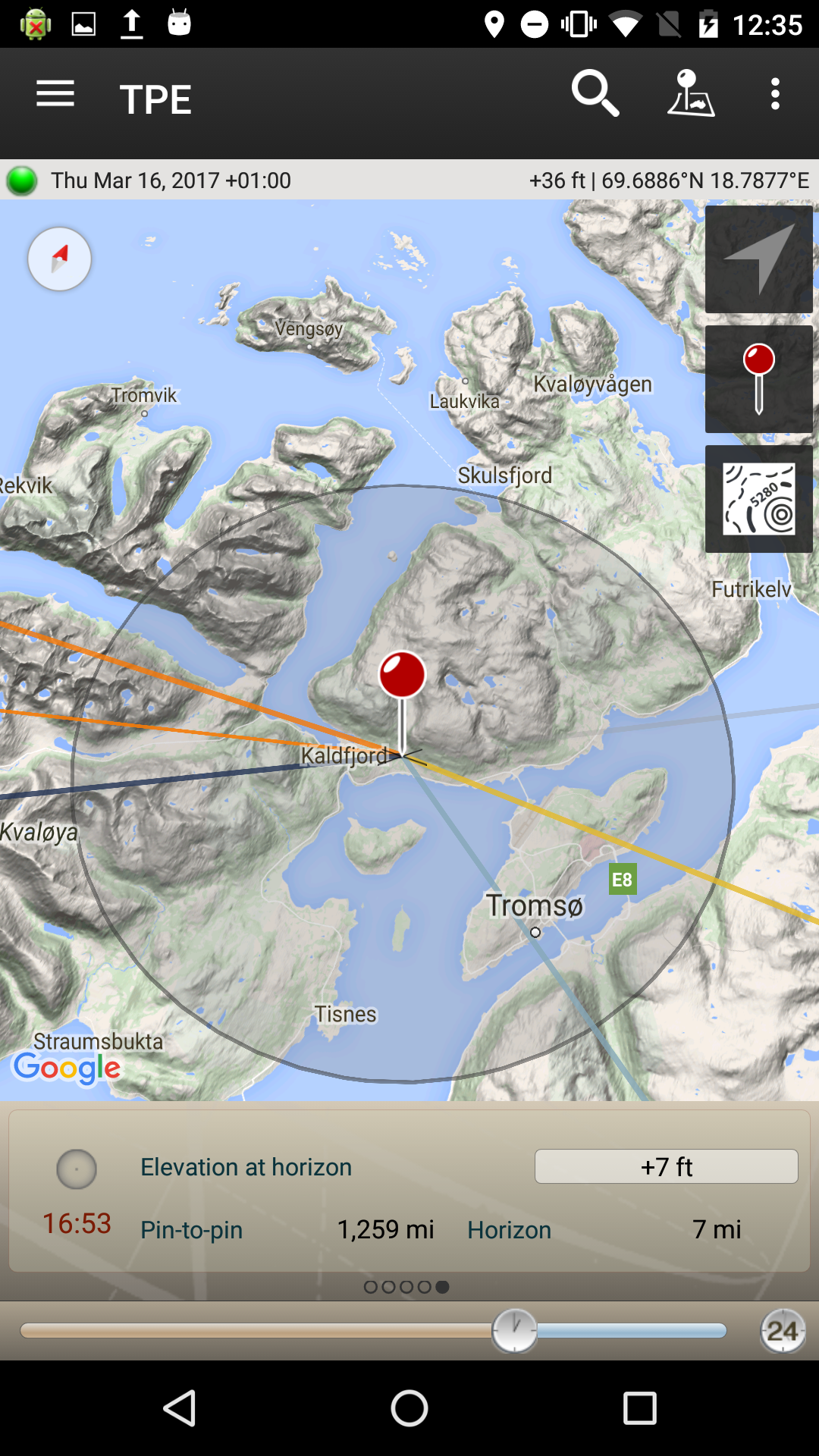
– Graphic representation on a map (Standard, Satellite / Hybrid, Terrain, Open Street Map, Open Cycle Map Topographic)
– Rotate and tilt the map for optimal view
– Automatic map rotation based on compass
– Movable map pins – slide the pin exactly where you need it
– Search for places by place name or directly enter coordinates
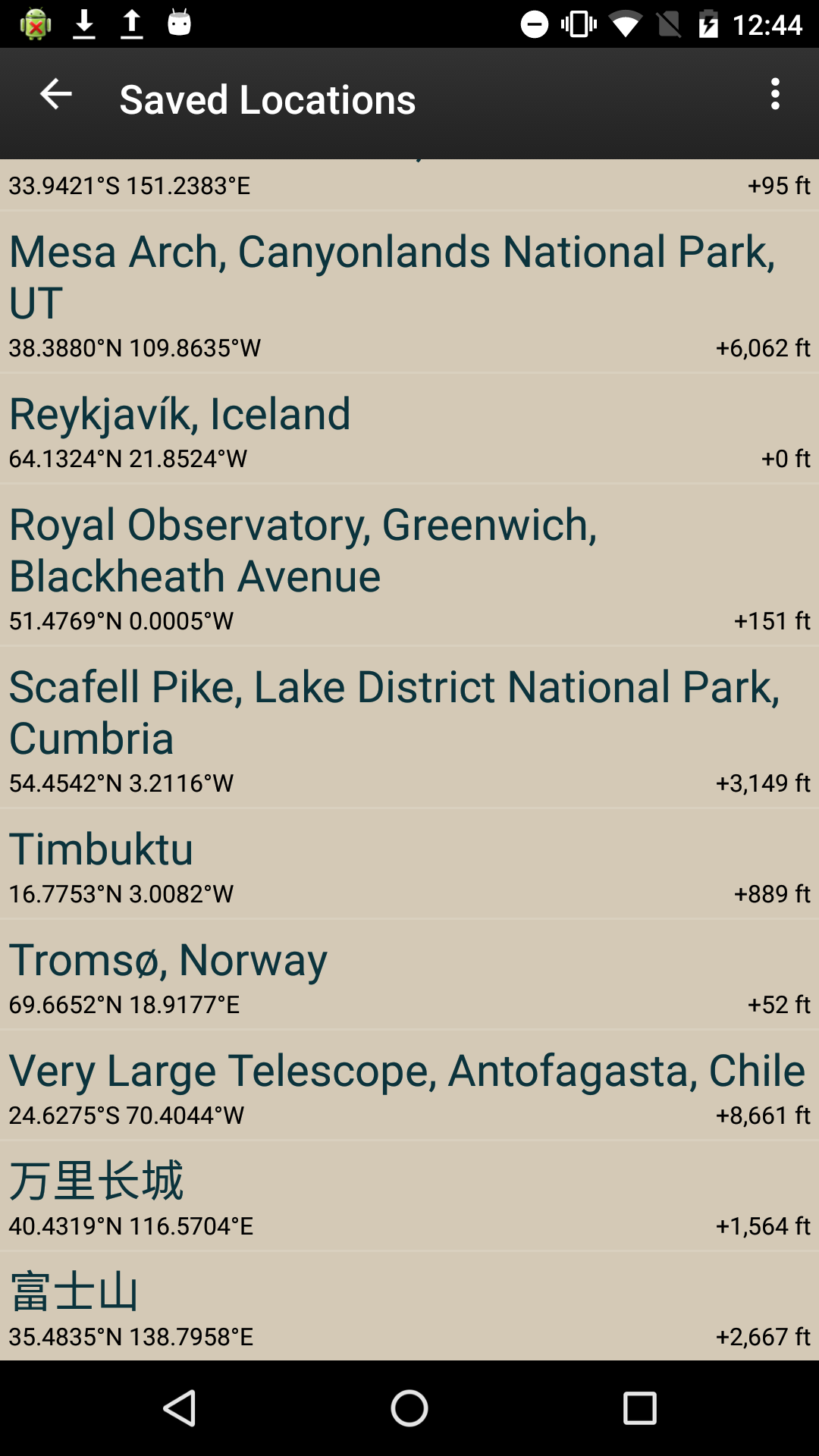
– Save any location you want – no fixed lists
– All functions available in portrait and landscape mode
– Does not require any network connection for sunrise / sunset times, azimuths and sun / moon position
Advanced features:
– Automatic time zone detection for any location on Earth
– Determine the height above sea level
– Display the azimuth and altitude of the sun / moon at any time of day / night
– Distance, bearing and elevation angle between any two points
– Import locations from KML files
– Offline use with Open Street Map and Open Cycle Map Topographic Maps
– Light pollution map overlay
Geek Features:
– Find when the sun / moon will appear behind a hill
– Compensation of atmospheric refraction
– Height compensation above the horizon
Remark:
– Maps and height-based calculations require a data connection to work (except for)
– Locations outside ± 80 ° latitude (very far north and south) are not supported
– The auto-rotating map requires a compatible device (with magnetometer and accelerometer)
– Requires Google Play and Google Maps services to be installed on your device. Most devices already have both installed. TPE will ask you to install them if they are missing.
End User License Agreement: http://photoephemeris.com/android-eula
If you’re having trouble installing Google Play services, visit http://photoephemeris.com/support#android_support.
The desktop TPE has been a favorite with photographers around the world for years. Now you can take it with you.