Hawk Map Pro APK v2.2 Patched Mod
Images
Description
⭐⭐Professional Features⭐⭐
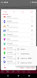
👉 List view for map markers.
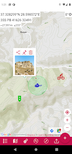
👉 Adding photos to map markers.
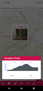
👉 View an altitude graph for a drawn route.
👉 Location search by address.
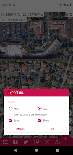
👉 Export the coordinates of the marked points in “CSV” format.
👉 More map options. (topographic, cycle path, etc.)
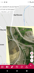
👉 Add custom map files in “mbtiles” format. (File content must be jpg or png, does not support vectors)
👉 Ability to add map URL to be able to use maps from different map providers.
👉 More marker icons.
👉 Without ads.
This app is a modern version of our “Mgrs & Utm Map” application.
GPS assistant and coordinate systems especially for military personnel.
It is also a comprehensive aid for airsoft, mountaineering, trekking and hiking, cross running, scouting, hunting, fishing, geocaching, off-road navigation and all other outdoor sports and activities.
With satellite navigation systems such as GPS, GALILEO and GLONASS (GNSS) supported by your device and sensors, you can see your most precise location on different map layers.
⭐⭐Features⭐⭐
👉 Coordinate marker, finder and converter
Format options:
– D°E” (WGS84)
– Latitude/Longitude (WGS84)
-UTM (WGS84/NAD83),
– MGRS / US National Grid (USNG) (WGS84/NAD83)
– SK42 (Gauss Kruger)
– British National Network (BNG-OSNG)
– Reference to the Irish network
– ED50 (6th-3rd)
-ITRF (6th-3rd)
👉 You can make colored marks on the map.
Markers, polygons, polylines, circles
👉 Measurement of area and distance
Distance unit options: m , ft , mi , yd , nmi
Area unit options: m² , ha , ft², yd², mi²
👉 About elevation
👉 Compass
Angular unit options: Degrees, NATO mil, Warsaw Mil, Grad
👉 Map Style Options: (Road, Terrain, Satellite, Night Mode, Hybrid)
👉 KML Viewer. (Export and import KML layers).
👉 GPS Track Recorder.