Aqua Map Marine – Boating GPS v21.7 Unlocked Mod
Images
Description
An app to satisfy all your fishing and boating needs, developed with the help of expert boaters. Download the best up-to-date nautical charts to safely enjoy the new navigation season. With the Aqua Map Master, turn your device into a real chartplotter.
►► Features:
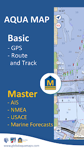
– Download maps to device for offline use
– Plan and navigate your ROUTE and tracks with real-time information on the next waypoint
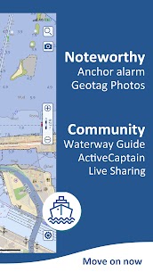
– Anchor alarm with advanced configuration
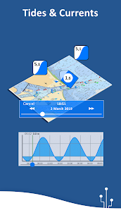
– Prediction and simulation of tides and currents
– Overlay USACE Surveys and USCG List of Lights on your maps (US only)
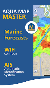
– Access the latest marine forecasts (wind, waves, currents and weather)
– Share and load tracks, markers and routes (KMZ and GPX)
– Connect with your friends using the live share feature
– ActiveCaptain & Waterway Guide community integration
– Connect your NMEA devices via WiFi
– Powerful search with advanced settings
– Display AIS information from external devices with automatic collision detection
– Overlay satellite images on your map
– Measure distances on the map
– Query map objects at your fingertips
– Check all bridges, hazards and best fuel prices along your route
► MAPS
Aqua Map only uses official nautical charts with depth contours, buoys, lights etc. to enjoy the best browsing experience. You can download the maps at home in your device and use them on the boat offline (no need for internet connection anymore).
► ROUTES and WAYPOINTS
Plan your trip, insert and edit waypoints. Navigate your route and track to monitor distance, time (ETA) and direction to your next waypoint or final destination.
► ANCHOR ALARM
This function will check your GPS position in real time against your previously set anchor position. An audible and visual alarm will sound as soon as your GPS position is out of the preferred range.
► TIDES & CURRENTS
You can calculate the prediction for more than 7500 stations in USA, Canada, Bahamas and Australia. You can also have a simulation of the T&C trend on the map and simulate any future date.
► UPLOAD and SHARE
You can share your favorite markers or send an email with your latest daily track. Not only that, you can also load any KML, KMZ, GPX (also compressed) found on the internet or received from your friends.
► LIVE SHARE
Activate the exchange of your data with the Aqua Map community and follow your favorite users on the screen. See all active users around you.
You can chat with them and send (and receive) your favorite routes/tracks/markers without leaving the Aqua Map app
► Active Captain
Join the community of over 100,000 boaters who write reviews, update data and provide up-to-date hazard information.
► River guide
Marinas, hazards, anchorages, bridges, free docks and more to cover the entire US coastline.
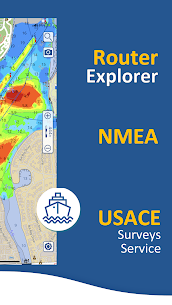
► Aqua Map Master
Access the latest marine forecasts (wind, waves, currents and weather).
Connect your NMEA devices via WiFi and use their data for all app functions
Show AIS targets on the map with automatic collision detection.
View the latest USACE Surveys and the latest USCG Lighthouse List (USA only).
Check the Route Explorer with anchorages, bridges, hazards, marinas and the best fuel prices (now also available for tracks)
What's new
• Lateral menu on big devices to view the map and the info at the same time
• Improvements and bug fixing